Area F · above Bagus Place
Bagus Tower
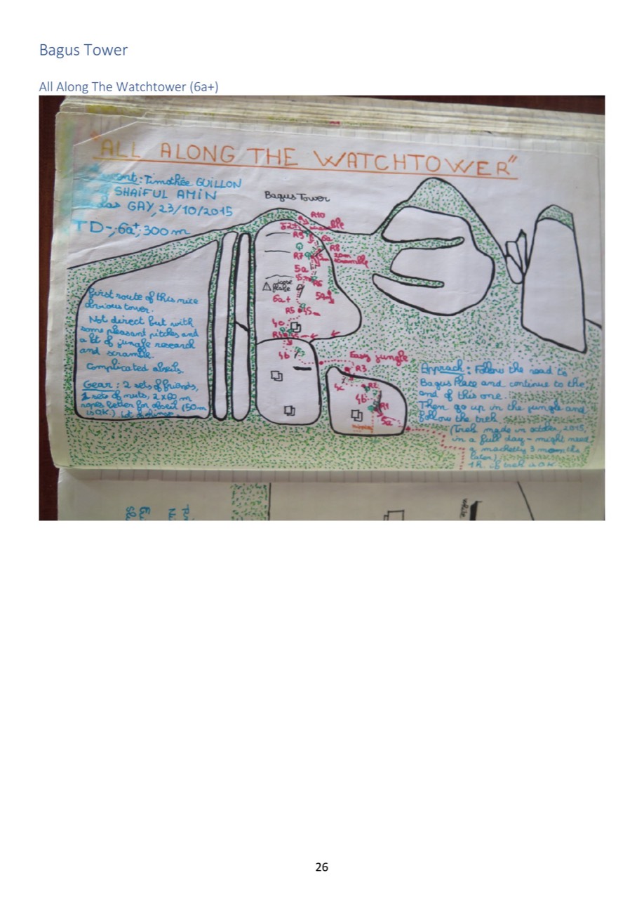
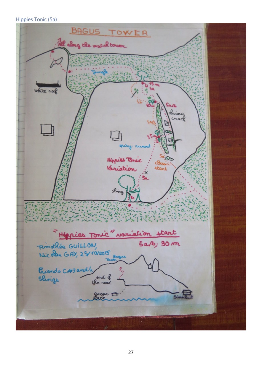
An obvious tower above the end of the Bagus Place road. Both its routes and both its topos come from a single French–Malaysian party in October 2015, and survive only as photographs of a logbook page.
1 / 2
Routes
Ordered as the source records them. Grades keep their original system. Compare across areas in the route finder.
Route Grade Length Pitches First ascent
All Along the Watchtower ★★★ 6a+ 300 m 10 Timothée Guillon, Shaiful Amin, Nicolas Gay 2015 Hippies Tonic ★★ 5a/b 90 m 3 Timothée Guillon & Nicolas Gay
2015